Stop being the address-lookup desk.

Your front office gets the same call dozens of times a week: “If I buy a house here, what schools will my child go to?” Most callers aren’t even residents yet — they’re house-hunting. Give your team a link to send back. Two seconds, done.

Live · Souderton ASD
What you get

Three pieces, one annual subscription.

Most districts start with the online map. The address updates and printed maps are why they stay year after year.

The link your office can text back

Parents, house hunters, realtors, and incoming families all ask the same question. Send them this map. They type the address, they see which elementary, middle, and high school it’s zoned for. Works on phones. Embeds on your district site. Updates as you change boundaries — no re-publishing.

  • Address search with attendance-zone lookup
  • Toggleable boundary layers (elementary, middle, high)
  • School contact info on every marker
  • Saved “quick views” for each school
Live · Pennridge SD

Address updates — we do them

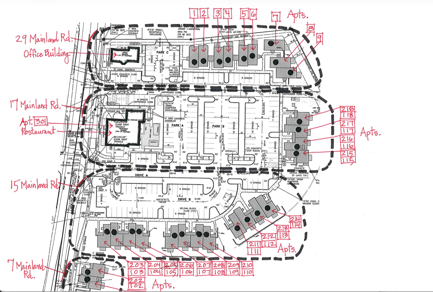
A new apartment complex going in on a street that doesn’t exist in any database yet? Send us the site plan. We add the addresses to your map and they show up in the search the same week — no waiting on Google or OpenStreetMap to catch up.

  • New construction and unbuilt streets handled by hand
  • Boundary changes turned around quickly
  • Direct email line — no ticket portals
Real site plan · Mainland Rd development Hand-annotated site plan for a new Mainland Road apartment development showing 50+ unit numbers on streets that don't exist in any geocoder yet

Custom print maps

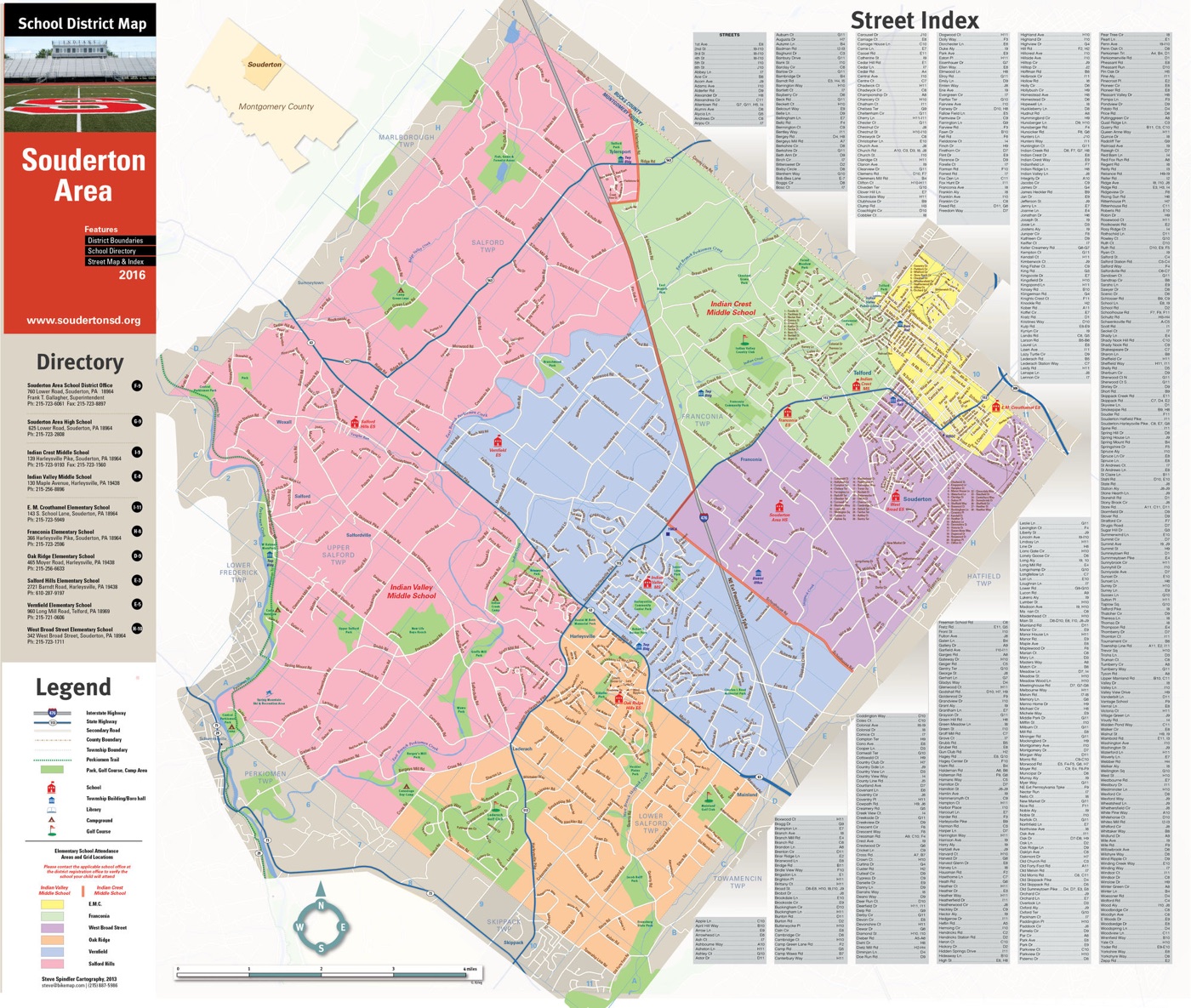
Wall maps for the board room. Kiosk posters for back-to-school night. Reference sheets for transportation routing. Designed by a working cartographer — not pulled from stock templates.

  • Any paper size, any audience
  • Same data as the online map — no version drift
  • Quoted per project (varies a lot)
Souderton Area SD · Print Souderton Area School District printed wall map with legend, school directory, and street index
Bonus · Included

Safe Routes to School project map

If your district participates in the federal Safe Routes to School program — or wants to start — we’ll set up a second map alongside your attendance map for collecting walking and biking route data, hazard reports, and crossing-improvement needs. Same platform, same login, no extra fee.

  • Map walking-distance zones around each school
  • Crowdsource hazards (missing sidewalks, dangerous crossings)
  • Document infrastructure asks for grant applications
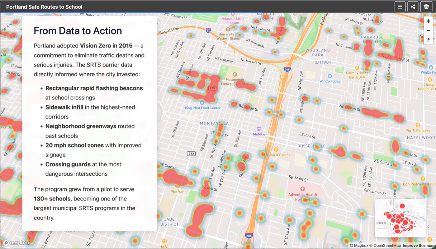
Portland Safe Routes to School barrier heatmap — hazards mapped across the city, used to inform Vision Zero infrastructure investments.
How setup works

Email what you have. We do the rest on a Zoom call.

No portals, no DIY editor to learn. You send us your boundary files, school list, phone numbers, and any existing materials. We schedule a Zoom and walk through the setup together while it’s fresh.

1.

Email what you want included

Boundaries (any common format), school list, phone numbers, anything else you want on the map.

2.

Zoom walkthrough

One call. We share the screen and configure the map with you so you see exactly how it works and can ask anything as we go.

3.

Leave the call with a clear plan

We set up what we can from what you’ve sent and hand you a short checklist for anything missing (boundary files, contact info, photos). Changes after launch are email-driven — no portal, no queue.

Live examples

Districts running on this today.

Both maps are the actual production sites parents use. Try the address search, toggle the boundaries, click a school.

Souderton Area SD
Pennridge SD
Open Souderton Open Pennridge
Pricing

One flat fee. Real human setup. A give-back built in.

Sized to fit a line item your business manager already understands — less than what one month of those address-lookup calls already costs your office in staff time. Every subscription supports getting kids and parents on bikes together.

Per district, per year
$869 / year
Roughly what one month of those “what school is this address zoned for?” calls already cost your office in staff time. Pay it once, save the rest of the year.
No risk — we set it up first. Show the working map to your board, superintendent, or the parents who’ll use it. You only commit to the subscription once everyone has approved. No buying anything you haven’t already seen running.
A share of every subscription supports youth and family bicycling programs — kids and parents riding together. Better than a drop-off line, more fun for everyone, and the kind of healthy habit a school district is uniquely positioned to encourage.
  • Hosted interactive map (your district URL or ours)
  • Address search and attendance-zone lookup
  • Ongoing address & boundary updates — just email us
  • School contact info, phone directory, saved quick-views
  • Optional Safe Routes to School project map — included, not extra
  • Zoom setup walkthrough with a working cartographer
Cartography is quoted separately. Wall maps, kiosk posters, and other printed work are priced per project because they vary a lot. Ask us in your setup email and we’ll send a quote.
Contact
Contact

Tell us about your district.

Email is the fastest way to reach us. Mention your district and what you’re trying to solve. We’ll answer your questions and put together something you can share with the decision-makers who need to sign off.

Reply within one business day. No call required.